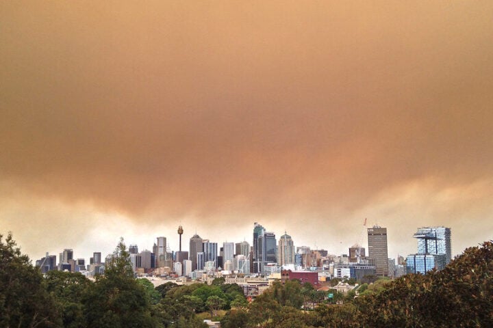
Townsville experiences its wettest day in 27 years as communities face repeated flood emergencies
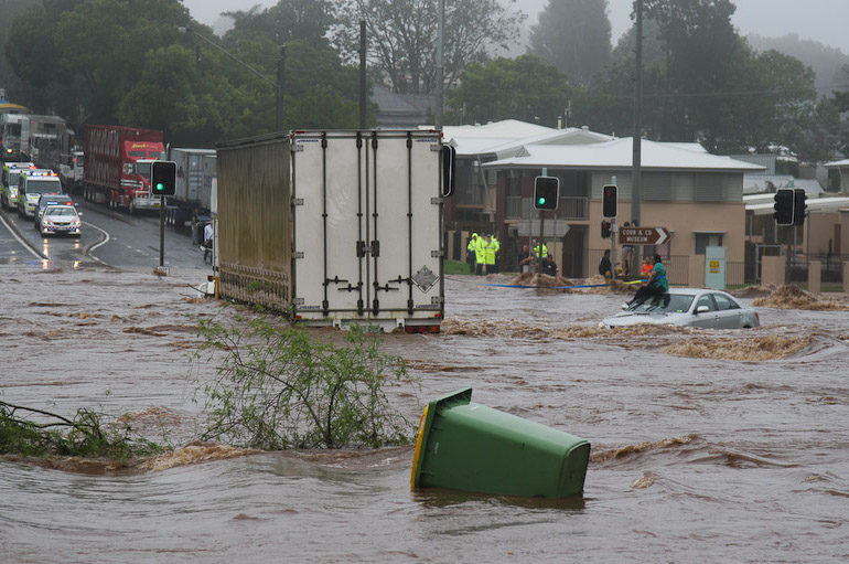
North Queensland residents are once again facing severe flooding after record-breaking rainfall hit the region this week, with Townsville recording its heaviest rainfall in nearly three decades.
Record Rainfall Swamps Townsville
Townsville was drenched with 301.4mm of rain in the 24 hours from 9am Tuesday to 9am Wednesday, making it the city’s wettest day since 1998. Most of the rain fell between 1am and 9am, catching many residents off guard as they woke to find roads swamped and homes inundated by flash flooding.
The deluge mirrors February’s severe weather event that saw the region hit with 710mm of rain over 72 hours. Many homes that flooded just weeks ago have again been inundated.
A weather station at Horseshoe Bay on Magnetic Island recorded an even higher total of 351mm, while Townsville Airport measured 203mm during the same period.
Herbert River Flooding Puts Communities on Alert
The Lower Herbert River near Halifax rose above the major flood level of 5.5 meters on Thursday morning, prompting emergency alerts for nearby residents. Local authorities urged people to move vehicles to higher ground as the river broke its banks.
Hinchinbrook mayor Ramon Jayo noted that while this week’s flooding hasn’t exceeded February’s levels, access remains a significant issue.
“There shouldn’t be any issue with any home inundations based on the current forecast,” Jayo said. “February we got to 5.71 [metres] at Halifax. 5.5 is a big one, it is up there, but we’re not expecting it to get much higher at this stage.”
Widespread Impact Across the Region
The persistent downpour has affected multiple communities between Townsville and Innisfail, with many areas recording over 200mm of rain in 24 hours:
- Cardwell Gap recorded the highest rainfall with 450mm
- Trebonne received 348mm
- Ingham measured 267mm
- Halifax recorded 226mm
These heavy rains have caused flash flooding and cut off access to several communities. The Bruce Highway closed between Ingham and Cardwell near the Seymour River on Thursday morning — the third time it has been cut by flooding this year.
Similar Posts
Weather System Expected to Move South-East
Bureau of Meteorology (BoM) meteorologist Miriam Bradbury explained that triple-digit rainfall totals have been feeding into flood catchments, leading to flash flooding and swollen waterways.
“This rain is feeding into our flood catchments,” Bradbury said. “The risk of higher falls will continue more likely this morning, however, even into tomorrow we may see heavier falls persisting where thunderstorms come in off the water.”
Multiple flood warnings remain active across the region:
- Major flood warning for the Herbert River
- Moderate flood warning for the Bohle River
- Minor flood warnings for the Tully River, Ross River, and Haughton River
- Generalised flood warning for Major Creek
Bradbury indicated that patchy showers and isolated storms are likely to continue across northern Queensland into the weekend, though with lower widespread rainfall totals.
February: A Month of Weather Extremes
This latest flooding comes just weeks after the region experienced a devastating flood emergency in February that killed two people and left 30,000 without power. Ingham was one of the worst-hit areas, with floodwaters from the Herbert River breaking a record set in 1967.
February 2025 has been recorded as one of the wettest months on record for some areas, with places like Paluma near Townsville receiving over two meters of rain.
Cyclone Recovery Continues Elsewhere
Meanwhile, recovery from Cyclone Alfred continues on the Gold Coast, where electricity has been restored to most residents after extended outages, particularly in hinterland communities.
Bonogin cafe manager Marshall Teague described the challenges of going without power for ten days: “The last 10 days have been pretty rough, the cyclone really tore its way through with trees down everywhere.”
Teague estimated his business lost about $1,000 worth of stock due to the electricity outages but noted how the disaster had brought the community together.

“Everyone’s helping each other clear down trees, chop up whatever you need to clear the roads,” he said.
Authorities continue to warn residents across affected regions to never drive through floodwaters, to keep vehicles away from trees, and to close doors and windows during severe weather events.
Frequently Asked Questions
How much rainfall did Townsville receive and how does it compare to previous records?
Townsville received 301.4mm of rain in 24 hours (from 9am Tuesday to 9am Wednesday), making it the city’s heaviest rainfall day in 27 years (since 1998). This recent deluge is reminiscent of the February 2025 floods when the region was hit with 710mm of rain over a 72-hour period.
Which areas in North Queensland were worst affected by the flooding?
Cardwell Gap recorded the highest rainfall with 450mm, followed by Horseshoe Bay on Magnetic Island (351mm), Trebonne (348mm), Ingham (267mm), and Halifax (226mm). The Lower Herbert River near Halifax rose above the major flood level of 5.5 meters, putting communities on high alert. The Bruce Highway was also closed between Ingham and Cardwell.
Is this flooding worse than the February 2025 floods?
According to Hinchinbrook Mayor Ramon Jayo, the current flooding hasn’t exceeded February’s levels. In February, the Halifax gauge reached 5.71 meters, while current levels are around 5.5 meters. However, the current flooding is still significant and comes just weeks after communities were devastated by the previous floods.
What flood warnings are currently in place for North Queensland?
There are multiple flood warnings active: a major flood warning for the Herbert River, a moderate flood warning for the Bohle River, minor flood warnings for the Tully River, Ross River, and Haughton River, and a generalised flood warning for Major Creek. The Bureau of Meteorology continues to monitor the situation closely.
What is the forecast for the coming days?
According to Bureau of Meteorology meteorologist Miriam Bradbury, the weather system is expected to move south-east with lower widespread rainfall totals. However, patchy showers and isolated storms are likely to continue across northern Queensland into the weekend, with the potential for localized heavy falls where thunderstorms develop.
How have previous weather events affected the region this year?
North Queensland has faced multiple severe weather events in 2025. February saw devastating floods that killed two people and left 30,000 without power, with the Herbert River breaking a record set in 1967. Additionally, Cyclone Alfred recently impacted the Gold Coast region, causing extended power outages particularly in hinterland communities. Some areas like Paluma near Townsville received over two meters of rain in February alone.