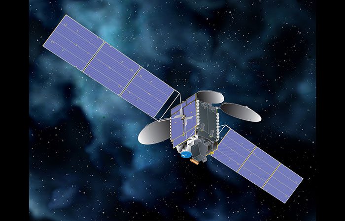
SpaceX is scheduled to launch the Intelsat 40E satellite into geostationary transfer orbit on April 7. It will be carrying out Nasa’s tropospheric emissions monitoring of pollution (TEMPO). The Falcon 9 rocket is scheduled to blast off from Cape Canaveral Space Force Station at 12:29 a.m. EDT (0429 GMT).
The launch could be viewed live on SpaceX’s YouTube channel and on Space.com and as usual, the webcast would begin 15 minutes before liftoff. The rocket has an almost two-hour window to launch the mission. Intelsat 40e is an advanced geostationary satellite that will provide high-throughput connectivity to all the required parties across North and Central America.
The Falcon 9 rocket booster on this flight is performing its fourth launch and is expected to land on the company’s drone ship A Shortfall Of Gravitas in the Atlantic Ocean about 8 minutes after liftoff. TEMPO will enable hourly snapshots of air pollution over North America. TEMPO will be measuring ultraviolet, visible, and near-infrared light spectra to detect levels of key pollutants, including ozone in the lower troposphere, formaldehyde, and nitrogen dioxide.
TEMPO’s geostationary position allows for a unique perspective of the atmosphere, providing much higher resolution data than other missions. The instrument was developed by Ball Aerospace. The hosted payload approach allows unused load capacity on Intelsat 40e to be leveraged for government missions, reducing the cost of access to space for the government and for Intelsat’s customers. The primary mission of TEMPO is supposed to last for 20 months, but it could continue working beyond that.
- Tesla Delays Affordable Model Y Production to Late 2025 Amid EV Market Pressure
- Aldi Pork Carnitas Alert: FSIS Warns of Metal Contamination in 16-Ounce Packages with June-July Use Dates
- Protected: Weekly Mailer Task
- GP Registration Online Now At 98.4% Of Practices As 3.8 Million Sign Ups Signal NHS Digital Shift
- Protected: Update the social media status in Content Calendar


