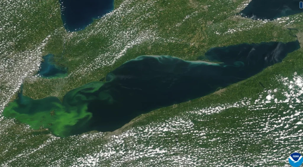
NOAA is working on its next generation of advanced geostationary satellites, the Geostationary Extended Observation mission, or GeoXO, after nearly 50 years of GOES satellites providing critical Earth observing data and imagery. One of those instruments being developed by BAE Systems is the Ocean Color Instrument (OCX), which will provide fine-scale data about the US coastal waters and the Great Lakes.
Jack Pan, founder of Ocean Motion Technologies, said, “OCX will provide us with near real-time, high-resolution data that is essential for monitoring ocean conditions and making informed decisions that benefit our clients in ocean science and conservation.” This more frequent and finer-scale data will be a game-changer compared to the current measurements from polar-orbiting satellites.
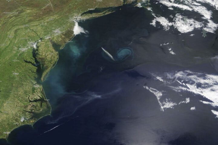
OCX will provide updated ocean and lake data at least every 3 hours, which is critical for end-users who need to track rapid changes in ocean biology and coastal dynamics. OCX will improve observations of water clarity and chlorophyll concentration, as well as provide better detection of harmful algal blooms and coastal pollutants.
Similar Posts
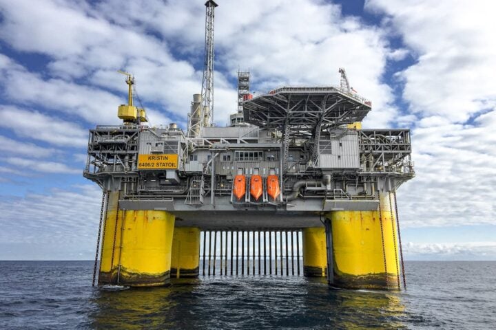
OCX’s data will also support the New Blue Economy, a sustainable and equitable ocean and coastal economy that optimizes advances in science and technology to create value-added, data-driven economic opportunities and solutions to pressing societal needs. Amber Sparks, co-founder of Blue Latitudes, a certified women-owned marine environmental consulting firm, said, “The data collected with OCX will aid us in better understanding how Blue Economy industries—like offshore energy—interact with fisheries and the environment by providing a fine-scale snapshot into the exclusive economic zone; this is critical to improve impact assessments and to foster a more responsible Blue Economy for the US.”
It is expected by NOAA that GeoXO will begin operating in the early 2030s, taking over for the GOES-R series as it nears the end of its operational lifetime. In short, GeoXo’s OCX instrument will be a game changer for satellite ocean observations by the 2030s.