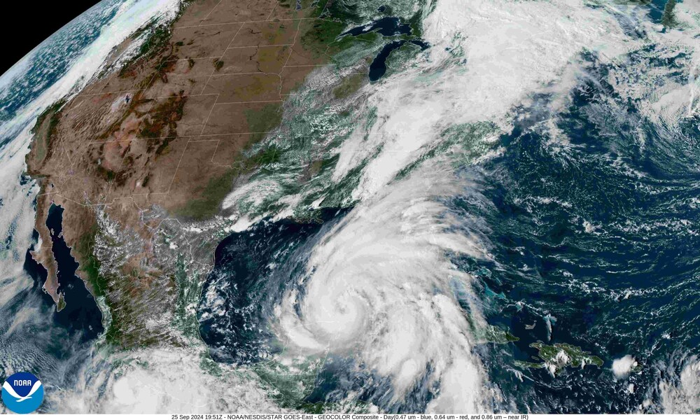
Details of the American continent, with its approximately 42 million square kilometers of extension including Argentina’s 2.78 million square kilometers, were never before documented with such luminosity, as photographed by NASA’s GOES-19 satellite at a distance of 35,800 kilometers (22,236 miles).
The North American space agency once again amazed the world by releasing a new image of the Earth that sets a new standard in space photography. While NOAA debuted the first images from GOES-19 on September 18, 2024, the satellite is still undergoing post-launch testing and will become operational in April 2025.
The unprecedented view of our sphere focuses with astonishing clarity on the New World, which occupies 28% of the total emergent lands and represents only 8% of the planet’s total surface. A strong green tone is mainly due to the Amazon rainforest, the Amazon basin in all its majesty, the forests of Central America and the eastern United States. In an angle at the southern end, the entire Argentine territory can be seen, where the Río de la Plata and the urban area of Greater Buenos Aires are discernible. The presence of few clouds leaves the Pampas region, Cuyo, the center of the country, and the Mesopotamia region exposed.
The Caribbean Sea, with Cuba in the middle, is displayed in all its splendor. The clouds cover some islands but allow a view of the Florida peninsula, a large part of Mexican territory, the Yucatan peninsula, and the rest of Central America.
The image was captured by the Advanced Baseline Imager (ABI) of the GOES-19 satellite, part of NASA’s Geostationary Operational Environmental Satellite (GOES) network. ABI can view the Earth with sixteen different channels, each measuring energy at different wavelengths along the electromagnetic spectrum. This allows to obtain information about earth’s atmosphere, land and ocean. This satellite, equipped with state-of-the-art technology generates spectacular images and provides valuable scientific data to study climate and terrestrial phenomena.
The photograph shows the characteristic bluish tone of the Earth, a product of the dispersion of solar light in the atmosphere, as well as a vibrant green color that highlights the vast expanse of the Amazon rainforest and the forests of Central America and the eastern United States.
GOES-19 can capture images of the Western Hemisphere regularly, which is essential for real-time monitoring of atmospheric and climatic phenomena. It is crucial for the prediction of storms, hurricanes, and other severe weather events, demonstrating that the beauty of this image also has a profound scientific utility.
On July 6, 2015, from a distance of 1.6 million kilometers (1 million miles) from Earth, images had been taken with one of the cameras on the Deep Space Climate Observatory (DSCOVR) satellite, a four-megapixel CCD camera with a telescope. The final photo was generated by combining three different images to create a result with a high level of detail. It was the first time in 43 years that a picture of the Earth fully illuminated by the Sun had been taken. In 1972, it had been captured during the last Apollo mission (17). The image showed the northern and central parts of the American continent and the turquoise waters of the Caribbean islands.
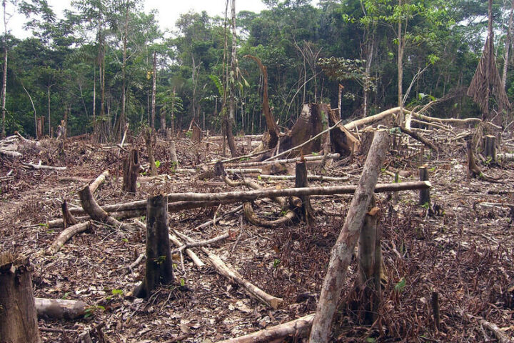
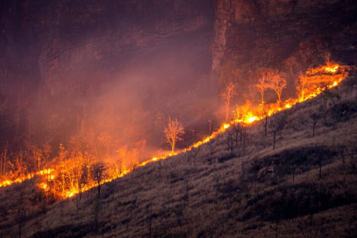
The hand of humanity on the world’s ecosystems has been negatively evidenced through new images taken of the Earth from space by NASA’s GOES satellite. The photographs have an impact even on the most skeptical about environmental warnings, as Brazil appears increasingly brown and less green in the Amazon region.
The GOES (Geostationary Operational Environmental Satellite), for those who are not familiar with it, are a series of meteorological devices operated by the National Oceanic and Atmospheric Administration (NOAA) of the United States. The entire set of satellites are positioned in geostationary orbit, which means they move around the Earth at the same speed as the planet rotates, allowing them to monitor large areas of the planet continuously.
This NASA initiative revealed new images of the Earth, and the results, at first glance, were truly alarming. Brazil, owner of the so-called “lung of the world” for its enormous tropical rainforest (the largest on the entire planet), no longer appears with a predominant green color when we see our home in the Universe from outer space.
Similar Posts
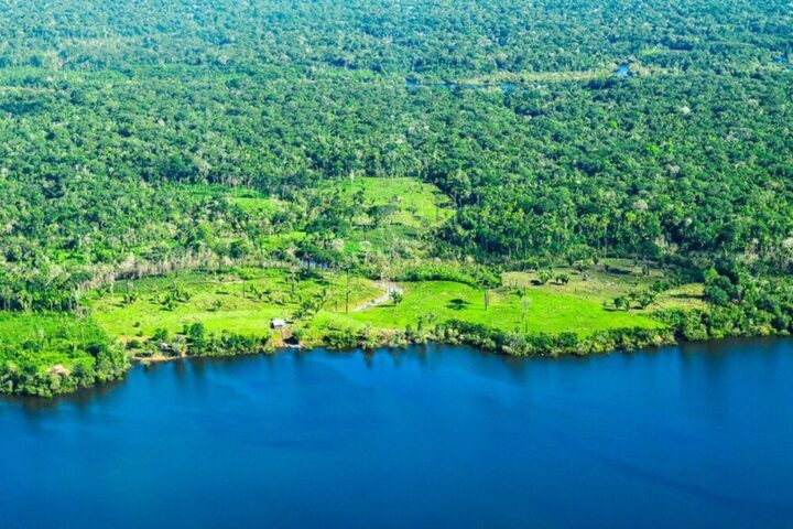
The Amazon is fundamental to the ecological and climatic health of the planet. It generates 16% of oxygen produced on land, making it a crucial player in atmospheric regulation. In addition to that, it acts as a large carbon sink, absorbing millions of tons of carbon dioxide (CO2) each year. This helps mitigate climate change by reducing the amount of greenhouse gases in the atmosphere.
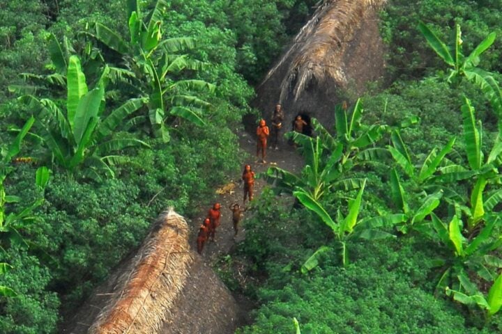
And if that weren’t enough, the Amazon is home to around 10% of the known species in the world, with thousands of plants, animals, and insects that cannot be found anywhere else. Many species have medicinal potential, and the loss of the rainforest implies the extinction of these unique life forms.
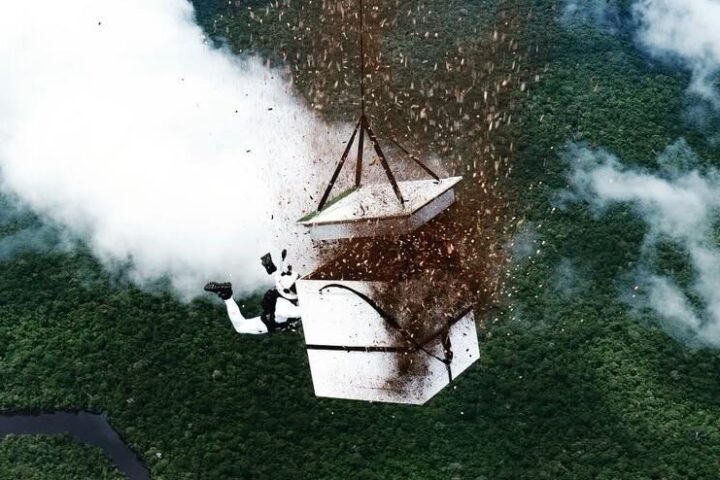
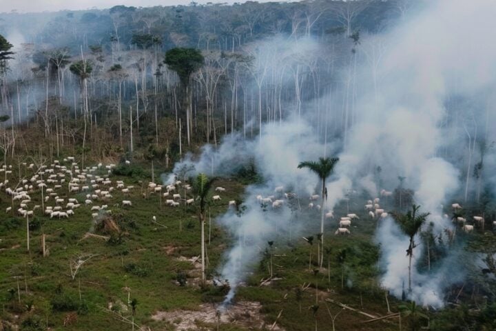
The Amazon, like any other ecological system on Earth, suffers from indiscriminate tree logging and deforestation, which, aside from threatening the species that live there, releases exaggerated amounts of CO2, which drives global warming.
These GOES images demonstrate that what happened in Rio de Janeiro in March 2024 – temperatures that approached 62.3°C in thermal sensation – was no coincidence: it was the planet communicating its discomfort.
The world of astronomy made news again this week when NASA surprised space enthusiasts with the clearest photograph of Earth taken to date. The image, captured by the GOES-16 satellite, offers a new view of the fully illuminated planet with certain details that surprised many.
In addition to carrying out research programs on outer space, the National Aeronautics and Space Administration, better known as NASA, shares videos and photographs of the new discoveries made by humans to carry out various investigations.
The image, captured by the GOES-19 satellite, offers a new view of the fully illuminated planet with specific details that surprised many. In addition to carrying out research programs on outer space, the National Aeronautics and Space Administration, better known as NASA, shares videos and photographs of the discoveries made by humans to carry out various investigations.
In this sense, the GOES-19 satellite can provide a broad panorama to monitor any atmospheric phenomenon. “Geostationary Operational Environmental Satellites (GOES) is a collaborative NOAA and NASA program providing continuous imagery and data on atmospheric conditions and solar activity ( space weather ). NASA builds and launches the GOES and NOAA operates them”. they note on NASA’s official website. They then add: “The GOES satellites orbit 22,236 miles above the Earth’s equator, at speeds equal to the Earth’s rotation. This allows them to maintain their positions over specific geographic regions to provide continuous coverage of that area over time.”
Thanks to the Advanced Baseliner Imager (ABI) on the GOES-19 satellite, the US agency can capture images and data on atmospheric conditions and weather in real-time in the event of any eventuality. This technology is capable of capturing images in multiple spectral bands that generate impressive photographs. On this occasion, it was able to photograph the Earth’s surface at an approximate distance of 35,800 kilometers and with a quality that allowed many details of the planet to be seen like never before.
It is worth noting that, in addition to appreciating the aesthetic beauty of the Earth from a different perspective, this type of capture serves the function of monitoring the environmental changes that can occur in different parts of the world.
This advanced satellite, which was launched in 2016 under the name GOES-R, is capable of taking this type of image every fifteen minutes, which constantly provides accurate information on any atmospheric, hydrological, oceanic, climatic, solar, and other critical space phenomena.