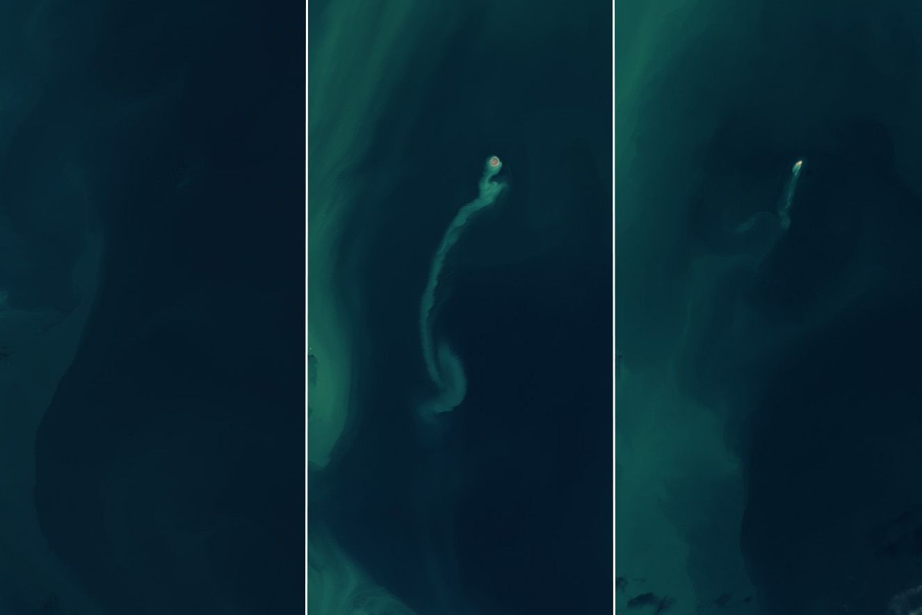
A temporary island emerged and vanished in the Caspian Sea between 2023 and 2024, documented by NASA’s Landsat satellites. The formation occurred 25 kilometers off Azerbaijan’s coast following an eruption of the Kumani Bank mud volcano.
NASA’s satellite data shows the complete timeline. The volcano remained underwater in November 2022. By February 14, 2023, satellite images captured a newly formed island measuring 400 meters across, with visible sediment trails in surrounding waters. The landmass gradually eroded, nearly disappearing by late 2024.
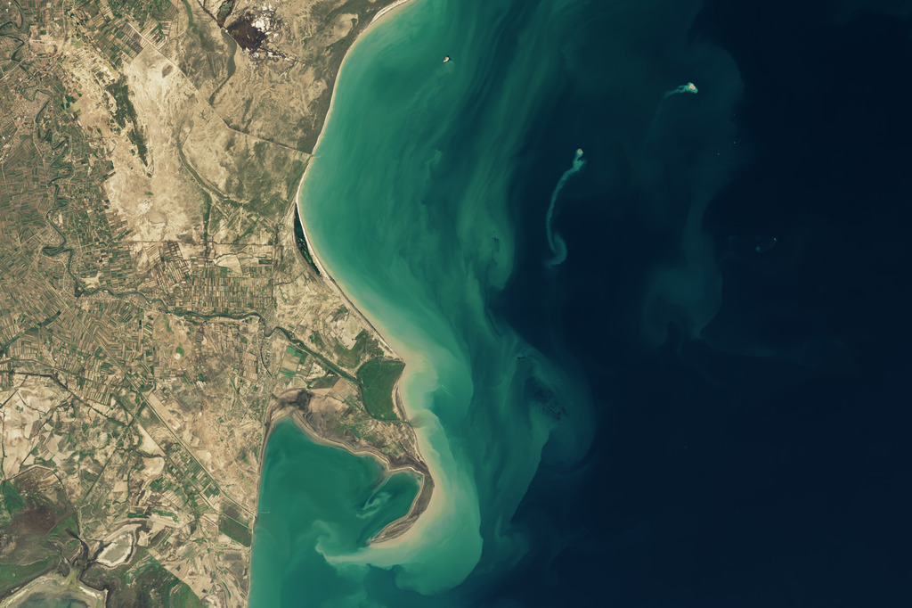
The Kumani Bank volcano, also known as Chigil-Deniz, has created similar temporary islands since 1861. The first recorded formation measured 87 meters wide and stood 3.5 meters above water, lasting less than a year. The largest appeared in 1950, reaching 700 meters across and 6 meters in height.
Similar Posts
Mark Tingay, a geologist at the University of Adelaide, explains that mud volcanoes form when underground pressure forces mud, gas, and water through the surface. “These mud volcanoes are weird and wonderful features that remain largely understudied and little understood,” he notes.
Azerbaijan’s eastern region contains over 300 mud volcanoes, both on land and underwater. This high concentration exists because the area sits where the Arabian and Eurasian tectonic plates meet. These geological formations can pose risks, as they sometimes release large amounts of material and flames reaching hundreds of meters high.
The South Caspian Basin’s hydrocarbon system connects these mud volcanoes, which regularly release methane gas with their muddy eruptions. While unclear if the 2023 eruption produced flames, previous events from nearby volcanoes created significant fire columns.
Scientists studying Mars have noted similar formations in the planet’s northern lowlands, suggesting some muddy mounds may have formed when gas and liquid-rich sediments reached the surface. The documented life cycle of this temporary island provides valuable data for understanding Earth’s geological activity.
The satellite tracking demonstrates how modern technology enables continuous monitoring of Earth’s changing surface.
