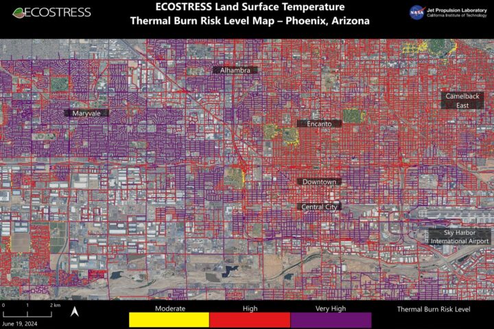
From Space to Streets: NASA’s ECOSTRESS Tracks 120°F Temps in Phoenix, Mapping Burn Danger Zones
Scorching pavement in Phoenix has been mapped by researchers at NASA’s Jet Propulsion Laboratory, showing that contact with the skin—from a fall, for example—can cause serious burns. Land surface temperatures are shown across a grid of roads and adjacent sidewalks, revealing how urban spaces can turn hazardous during hot weather. A NASA instrument aboard the International Space Station collected data for this visualization of the Phoenix area—the fifth most populous city in the U.S.—at 1:02 PM local time on June 19, 2024. The instrument, called ECOSTRESS (Ecosystem Spaceborne Thermal Radiometer Experiment on Space Station), measures thermal infrared emissions from Earth’s … Continue reading From Space to Streets: NASA’s ECOSTRESS Tracks 120°F Temps in Phoenix, Mapping Burn Danger Zones
