Tropical Cyclone Alfred is expected to strengthen into a category three system on Wednesday morning as it moves slowly south in the Coral Sea, according to the Bureau of Meteorology.
The cyclone formed on February 23, 2025, about 910 kilometers northeast of Cairns and has been steadily intensifying. As of early Tuesday, the system was located 900 kilometers east of Mackay and 570 kilometers east north-east of Willis Island.
“Today and tonight, we expect it to very slowly move towards the south-east and slowly intensify as well,” said Bureau of Meteorology senior meteorologist Dean Narramore.
The cyclone is predicted to reach category three strength by Wednesday morning and maintain that intensity through Thursday and Friday as it tracks slowly southward, moving further away from the Queensland coast.
## Potential Impact and Warnings
Strong wind warnings have been issued for coastal waters from Townsville to Fraser Island for Tuesday and Wednesday. While the cyclone is currently not expected to directly impact the Queensland mainland, coastal communities may experience gusty winds and isolated showers.
“About our coastal communities and our offshore islands, particularly from around Fraser Island all the way out through Townsville, it’s almost looking at no impact to Queensland,” Narramore said.
The bureau has emphasized that a category three system still carries significant danger if it does move closer to land.
“We could see gusts up to 220 kilometers an hour,” said BOM senior meteorologist Miriam Bradbury. “So that’s very destructive.”
Similar Posts
## Future Path Remains Uncertain
Meteorologists are monitoring several possible scenarios for the cyclone’s movement over the weekend and into next week.
“[The cyclone] could come towards the coast as we move into the late weekend,” Narramore explained. “Some [scenarios see it] continue moving further south, well off the Queensland coast and continuing that well into next week. Some even weaken it below cyclone strength as we get towards the weekend into early next week.”
The unpredictable nature of the cyclone’s path has prompted officials to urge residents to stay informed.
“There are a number of different ways this cyclone could track, so our advice at this point in time is for all communities to really just keep a close eye on the forecasts and any warnings that might come out,” Bradbury said.
## Preparation Advised Despite Uncertainty
State Emergency Service Rockhampton region controller Jasper Humphries stressed that early preparation is crucial, regardless of the current forecast.
“It’s important with any severe weather events coming up to have a plan, have your emergency plan and make a kit, but also look around your home,” he said.
Humphries recommended trimming overhanging tree branches and securing loose items in yards now, rather than waiting until the last minute.
“It saves time now so you’re not worrying about it as the events happening or as the event is about to happen… so you can be as prepared as you can,” he said.
## Coastal Warnings
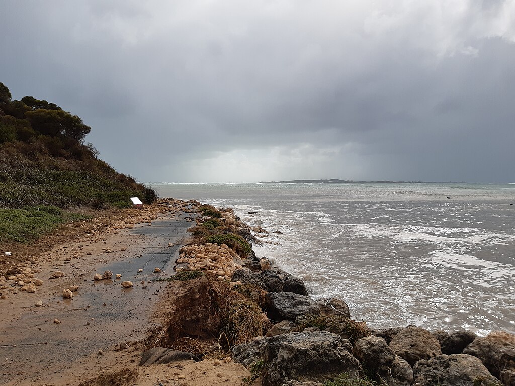
Surf Live Saving Queensland regional operations manager Darren Everard warned of potential dangerous ocean conditions.
“If there’s a big swell running after rain events and there’s debris coming out of the creeks and the rivers, just be really, really mindful,” he said.
Everard urged coastal residents to stay informed through local council disaster dashboards and emphasized the dangers of flooded waterways.
“If it’s flooded, forget it — we don’t want people driving in flooded creeks and needing to be rescued,” he said.
The cyclone has already caused disruptions, with a music festival scheduled for Great Keppel Island this weekend being postponed due to the forecast of severe winds.

The name “Alfred” was chosen for the cyclone instead of “Anthony” to avoid any confusion with Prime Minister Anthony Albanese, as a federal election approaches.
Residents in potentially affected areas have been advised to monitor the Bureau of Meteorology’s track maps and warnings throughout the week.