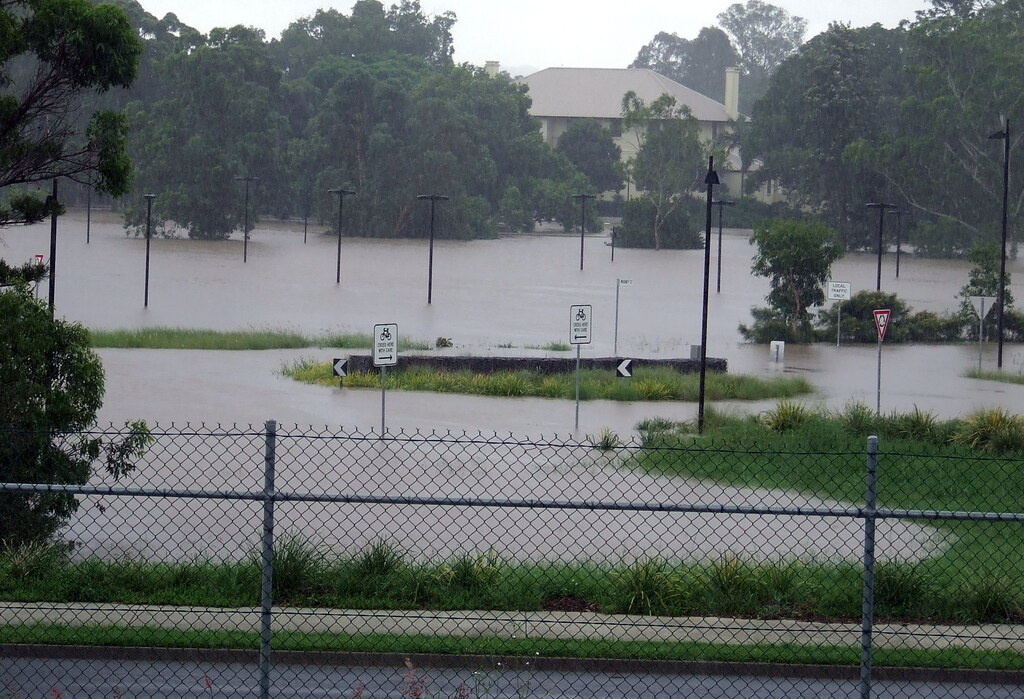
Tropical Cyclone Alfred is heading for Queensland’s coast, expected to make landfall between Brisbane and Noosa late Thursday or early Friday. Currently a category two system, Alfred threatens to bring winds up to 120km/h, rainfall of 200-400mm, and potential flash flooding.
“Up to four million Queenslanders could be without power for at least three days once Alfred makes landfall,” warns the Queensland State Emergency Service, which has issued a three-step preparedness plan.
Historical Context
This is rare weather for southeast Queensland, which hasn’t seen a cyclone cross its coast in 51 years. The last was Cyclone Wanda in January 1974, which caused devastating floods. According to weather data, cyclones in this densely populated region typically cause significant damage.
Current Status
As of 11am AEST Tuesday, Cyclone Alfred was located about 630km east of Brisbane. Satellite images show its convective clouds (where heavy rain occurs) positioned south of the system’s center – a sign that wind shear is affecting its structure.
“Tropical cyclones don’t like wind shear because separating the low-level circulation centre from the convection typically prevents the cyclone from gaining strength,” Weatherzone reports.
Alfred is expected to remain around category one or two strength and is “unlikely to become a severe tropical cyclone (category three or higher).”
Similar Posts
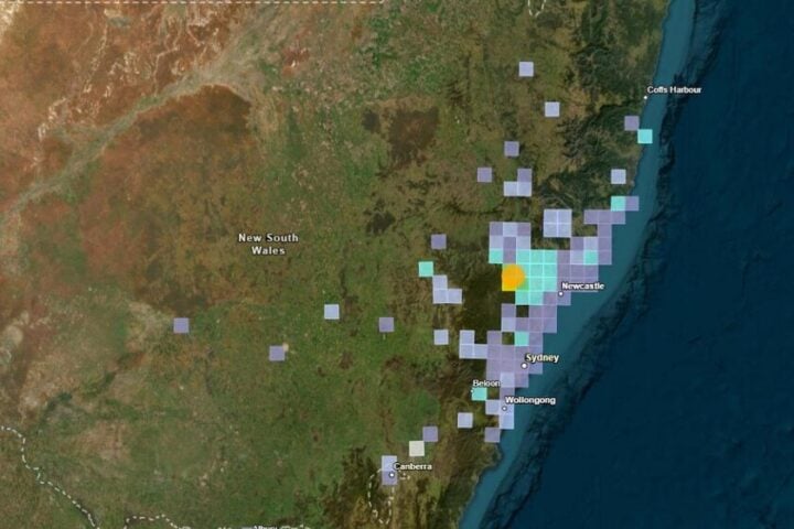
Predicted Path
After becoming slow-moving Tuesday, Alfred is expected to turn westward mid-week. The Bureau of Meteorology’s forecast track map shows a “Range of Likely Tracks of Cyclone Centre” covering approximately 300km of coastline, from Double Island Point to just south of the Queensland-NSW border, encompassing the Gold Coast, Brisbane, and Sunshine Coast.
“Tropical cyclones are notoriously difficult to predict and their forecast tracks can change a lot from day to day,” Weatherzone notes, advising residents in southeast Queensland and northeast NSW to “keep a close eye on the latest tropical cyclone advisories.”
Preparing for Power Outages
With extended blackouts possible, residents should:
- Prepare candles, matches, and battery-powered torches
- Fully charge phones and communication devices
- Have spare power banks ready
- Ensure gas supplies for barbecues or cookers
- Stock non-perishable food
The Food Safety Information Council advises: “If your freezer is efficient, and its door seals are in good condition, it can maintain foods in a frozen state for between one and two-and-a-half days.”
For lighting during blackouts, pointing a torch toward the ceiling can maximize illumination. Importantly, power generators should never be used indoors due to dangerous carbon monoxide levels.

Expert Guidance
University of Queensland experts and Natural Hazards Research Australia emphasize early preparation and community resilience as critical factors in reducing damage and ensuring safety during the cyclone.
Frequently Asked Questions: Cyclone Alfred
Cyclone Alfred is expected to make landfall between Brisbane and Noosa late Thursday or early Friday. However, the forecast track covers about 300km of coastline from Double Island Point to just south of the Queensland-NSW border, including Gold Coast, Brisbane, and Sunshine Coast.
Currently a category two system, Alfred is expected to maintain that intensity as it approaches. It’s likely to bring wind gusts up to 120km/h, rainfall between 200-400mm, and potential flash flooding. Up to four million Queenslanders may experience power outages for at least three days.
Follow the Queensland SES three-step plan: secure your property, prepare emergency supplies (food, water, medications), and stay informed through official channels. Charge all devices, prepare non-perishable food, have candles/torches ready, and ensure your gas supply for cooking is full.
Very rare. Southeast Queensland hasn’t experienced a cyclone crossing its coast in 51 years. The last major event was Cyclone Wanda in January 1974, which caused catastrophic floods.
Use perishable items first. Minimize opening the refrigerator/freezer. After power has been out for two hours, move items from the fridge to the freezer if possible. Generally, discard perishable food after four hours without power. Items like salted butter, margarine, and hard cheeses remain safe at room temperature.
Tropical cyclones are notoriously difficult to predict with precision. Current forecasts represent the most likely scenario based on computer modeling, but residents in the potential impact zone should stay updated with the latest advisories from the Bureau of Meteorology as tracks can change significantly from day to day.