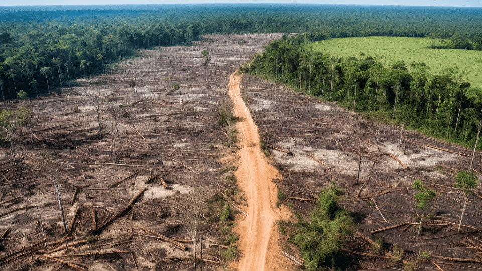
In a remarkable environmental turnaround, deforestation in Brazil’s Amazon has dropped by 22.3% in the 12 months through July, according to recent government data. This decline marks a significant achievement for President Luiz Inacio Lula da Silva, who pledged to curb the rampant deforestation that escalated under his predecessor, Jair Bolsonaro. Notably, this reduction has led to the smallest area of the Amazon being cleared since 2018, the year before Bolsonaro’s tenure began. The Amazon, known as the world’s largest rainforest, plays a crucial role in climate change mitigation, making its protection a global priority.
Page Contents:
- The Stark Reality: INPE’s 2023 Deforestation Estimates
- Geographical Breakdown: State-wise Deforestation Analysis
- Mapping the Crisis: Visualizing Deforestation with PRODES 2023
- State-wise Distribution: A Closer Look at the Numbers
- Simulated Estimations: Predicting Deforestation Trends
- Historical Context: Analyzing Deforestation Rates Since 1988
- Annual Changes: Understanding Year-over-Year Fluctuations
- Comparative Analysis: From PRODES 2022 to 2023
- Simulated Statistics: A Scientific Approach to Estimation
- Navigating the Path Ahead
The Stark Reality: INPE’s 2023 Deforestation Estimates
Despite the recent decline, the National Institute for Space Research (INPE) reports a concerning increase in deforestation within the Legal Amazon for 2023. The estimated deforestation area stands at 9,001 km², a significant figure that underscores the ongoing challenges in forest conservation. The state of Pará leads in deforestation rates with an estimated 4,008 km², followed by Mato Grosso with 1,950 km², and Amazonas with 1,540 km². These numbers highlight the regional disparities in deforestation impacts and the need for continued vigilance.
Geographical Breakdown: State-wise Deforestation Analysis
The deforestation occurrences are unevenly distributed across the Legal Amazon. Pará, Mato Grosso, and Amazonas are the most affected states, with Pará alone accounting for over 36% of the total deforestation. Rondônia, Acre, and Roraima also show significant forest loss, contributing to the overall environmental degradation. The data, gathered using satellite images from August 2022 to July 2023, points to illegal logging and land clearing for agriculture as primary drivers of this deforestation.
Mapping the Crisis: Visualizing Deforestation with PRODES 2023
The INPE report provides a visual representation of deforestation occurrences across 117 Landsat scenes. The map, marked with red to indicate deforestation hotspots, uses cartographic parameters like the SIRGAS 2000 datum for accuracy. It also includes ancillary geographic information, such as hydrography, to provide a comprehensive understanding of the deforestation patterns.
State-wise Distribution: A Closer Look at the Numbers
The INPE report offers a detailed state-wise distribution of the estimated deforestation areas. Pará, with 3,272 km², and Amazonas, with 1,553 km², emerge as the states with the highest deforestation rates. This table is crucial for formulating state-specific conservation strategies and highlights the need for targeted interventions.
Simulated Estimations: Predicting Deforestation Trends
Report also presents deforestation estimates using 1120 sample sets from 95 scenes. This simulation provides a range of deforestation outcomes, from maximum to minimum values, for each state. It serves as a predictive tool, illustrating potential deforestation scenarios based on current trends.
Historical Context: Analyzing Deforestation Rates Since 1988
The report offers a historical perspective, depicting annual deforestation rates from 1988 onwards. This data reveals a peak in deforestation around the late 1990s and early 2000s, followed by fluctuating rates. The estimated rate for 2023 indicates a continuation of the recent downward trend, albeit with a significant increase from the previous year.
Annual Changes: Understanding Year-over-Year Fluctuations
The INPE report shows the relative annual change in deforestation rates, highlighting the year-over-year percentage fluctuation. This data illustrates the variable nature of deforestation, with significant reductions in some years and increases in others. The estimated relative change for 2023 suggests a continuation of the recent trend of deforestation rate reduction.
Comparative Analysis: From PRODES 2022 to 2023
The report carefully compares the deforestation areas from PRODES 2022 to 2023, revealing a decrease from 11,594 km² to 9,001 km² in the Legal Amazon. This highlights the variability in deforestation trends across different states, informing targeted regional policy responses.
Simulated Statistics: A Scientific Approach to Estimation
Simulated deforestation statistics for 2023 also presented in the report, including standard deviation, mean, and median values. This detailed statistic aids in understanding the complexity and variability of deforestation predictions, which is essential for formulating accurate environmental policies.
Navigating the Path Ahead
The INPE’s report on Amazon deforestation in 2023 paints a grim picture of the current state of one of the world’s most vital ecosystems. However, the recent decrease in deforestation rates under President Luiz Inacio Lula da Silva’s administration offers a glimmer of hope. As the Amazon continues to face unprecedented challenges, the global community must rally to protect this invaluable natural resource, ensuring its preservation for future generations. The fight against deforestation in the Amazon is not just a regional concern but a global imperative, demanding concerted efforts and sustainable solutions.





![Representative Image: European Starling [49/366]. Photo Source: Tim Sackton (CC BY-SA 2.0)](https://www.karmactive.com/wp-content/uploads/2025/04/Starlings-Drop-82-in-UK-Gardens-as-Birdwatch-2025-Reveals-Record-Low-Count-Since-1979-720x480.jpg)
