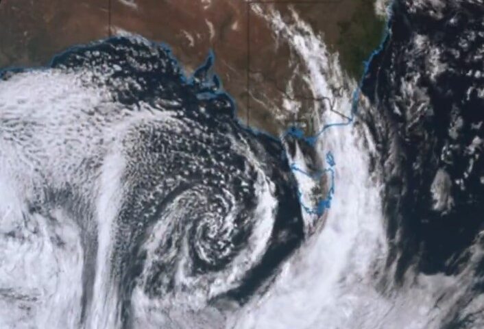
Cyclone Alfred is set to make landfall between the Sunshine Coast and Brisbane on Thursday as a category one or two system, making it the first cyclone to cross South East Queensland’s coast since Cyclone Zoe in 1974.
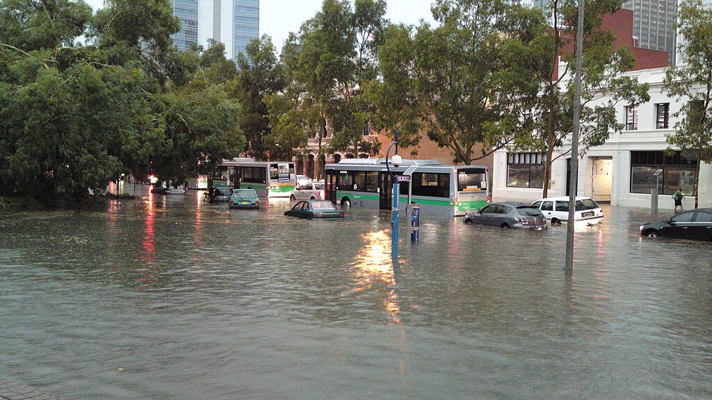
The cyclone currently sits as a category-two system with winds at its center reaching 95 km/h and gusts up to 130 km/h. The Bureau of Meteorology (BOM) has issued warnings for damaging winds, heavy rainfall, and flash flooding across both Queensland and parts of northeastern New South Wales.
“We are seeing sustained winds near the centre of the cyclone of 95 kilometres an hour, and wind gusts to 130 kilometres an hour,” said meteorologist Jonathan How.
Widespread Impact Expected
Close to two million properties worth billions of dollars are in the alert zone, including 1.17 million houses, nearly 450,000 units and flats, 91,000 businesses, and 173,000 farms. Fourteen regional and local council areas are under alert.
The Sunshine Coast Regional Council has identified four particularly vulnerable suburbs: Golden Beach, Pelican Waters, Diamond Head, and Maroochydore. Recent tracking maps suggest landfall between Buddina and Warana on the Sunshine Coast.
“It’s not impossible, it is unusual, and it’s important that people be ready for it,” Queensland Premier David Crisafulli told ABC Radio.
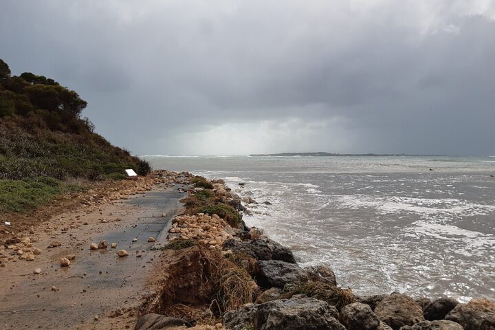
BOM Manager of hazard preparedness Steven Bernasconi warned of abnormally high tides and severe coastal erosion from K’Gari Island south to the Gold Coast. “The coastline will really cop quite a battering from this,” he said.
Similar Posts
Emergency Preparations Underway
Brisbane Lord Mayor Adrian Schrinner has convened the council’s local disaster management group and urged residents to prepare their properties.
“A cyclone in Brisbane is something many of us have never experienced before, so getting prepared now is the only way to ensure your home, pets and loved ones stay safe,” Schrinner said.
Acting Police Commissioner Shane Chelepy expressed particular concern for low-lying coastal areas that have not experienced severe winds or waves for some time.
“I ask you to think about the risk for you and make a decision as to whether or not you should leave those islands – and when you should leave those islands – because that window to leave the island will close later in the week should this system turn west and head towards the Queensland coast,” Chelepy said.
Extending Into Northern NSW
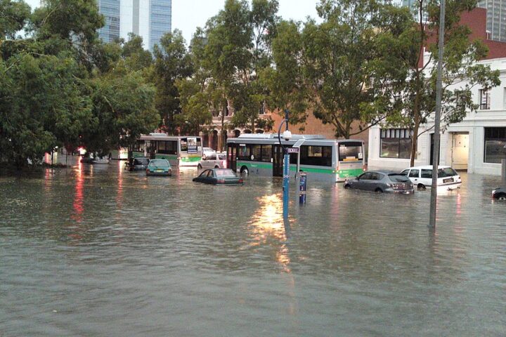
The cyclone’s effects will extend into New South Wales, with the Northern Rivers region from Coffs Harbour to the Queensland border expected to be most affected. Flood watches are in place for all coastal catchments from Tweed down to Camden Haven for moderate to major flooding.
NSW Minister for Emergency Services Jihad Dib reminded residents of the devastating floods in the Northern Rivers area three years ago. “We will do everything that we can in working with that community, in making sure that our communities are well prepared, well protected, and can respond to whatever comes our way.”
NSW State Emergency Service Superintendent Scott McLennan warned that the cyclone’s landfall would bring significant erosion, wind speeds of approximately 89 to 110 km/h with gusts up to 125 km/h, and waves of 2 to 9 meters in the Northern Rivers.
“We are asking our residents and our visitors to also be prepared,” McLennan said. “Take the time now to clean your gutters, clean your drains, make sure that any loose items including trampolines and pot plants are tied down.”
Insurance Concerns
Comparison site Finder warns that an estimated 54,000 Queensland households do not have home and contents insurance – about one in three homes – despite 80 percent of households expressing concern about wild weather risks.
“This could be the first tropical cyclone to hit Brisbane in 50 years and households are very concerned about how wild weather will impact their homes,” said Finder’s insurance expert Tim Bennett. “Intense rain could lead to flooding and wind gusts could be damaging leaving them vulnerable to expensive repairs and event displacement.”
Prime Minister Anthony Albanese has confirmed that funding support will be available to Queensland. “We hope of course for the best outcome possible, but we will stand with Queenslanders at this difficult time,” he said.

Sport Events Under Review
The AFL season opener in Brisbane between the Geelong Cats and Brisbane Lions is being monitored, with contingency plans in place. The NRL’s Dolphins and Rabbitohs match on Friday is also under review as officials assess weather developments.