A rapidly strengthening storm system enhanced by an atmospheric river brought widespread disruption across the Eastern Seaboard on Wednesday, delivering wind gusts exceeding 70 mph, record-breaking rainfall, and extensive power outages from the Carolinas to New England between 4 p.m. Wednesday and 2 a.m. Thursday.
Wind gusts exceeding 70 mph swept through the region, with Massachusetts recording severe winds at higher elevations. New York City experienced gusts near 50 mph, while Providence, Rhode Island shattered its daily rainfall record with 2.4 inches by Wednesday afternoon.
“The high winds expected with this storm have the potential to bring down trees and limbs onto electric lines and equipment, causing outages, and we’re planning accordingly,” stated Steve Sullivan, president of Eversource Connecticut.
Severe Storm Risk and Tornado Threat
The National Weather Service Storm Prediction Center issued a Level 2 out of 5 risk for severe thunderstorms from northeastern South Carolina to Cape Cod in Massachusetts. “Isolated severe thunderstorms are possible today across the East Coast States, as far north as southern New England. The most probable area for a few tornadoes and damaging winds appears to be centered on eastern North Carolina from midday onward,” the agency reported.
The risk window for the Carolinas extended from late morning through evening, with supercell development possible ahead of the main squall line.
Widespread Power Outages and Transportation Chaos
Nearly 90,000 customers lost power in Maine alone by Thursday morning, with additional outages reported across Florida, Georgia, South Carolina, Virginia, Pennsylvania, and Ohio. North Carolina faced approximately 20,000 outages due to downed trees and power lines.
The transportation sector faced severe disruptions. Over 4,000 flights experienced delays nationwide, with nearly 800 cancellations. Boston Logan International Airport and Washington D.C.’s Reagan International Airport reported the most severe impacts, with average delays spanning 1-3 hours. Amtrak services in Massachusetts operated at reduced speeds.
Parts of Interstate 93 and 90 in Boston experienced flooding, though authorities worked swiftly to clear drainage systems and restore traffic flow.
Flood Risk and Rainfall Potential
The atmospheric river system tapped into warm tropical waters off the Southeast coast, creating moisture levels rarely observed in the Northeast outside tropical systems. The Weather Prediction Center issued a Level 2 out of 4 risk for excessive rainfall across the region.
Expected rainfall totals exceeded 2 inches across Long Island, Connecticut, Rhode Island, Massachusetts, New Hampshire, and Maine, with localized amounts potentially exceeding 4 inches. The combination of warm temperatures and melting snow raised additional concerns for flash flooding in the Northern Berkshires and Worcester Hills toward the Massachusetts/New Hampshire border.
The National Weather Service office in Mount Holly, New Jersey, cautioned: “The main concerns will be urban and poor drainage flooding and ponding on roadways.”
State of Emergency in New York
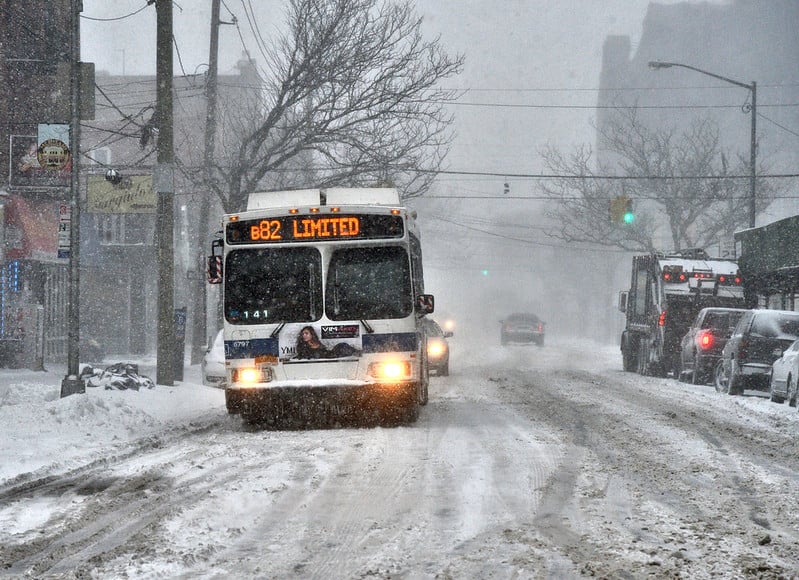
New York Governor Kathy Hochul declared a state of emergency in several counties, including Jefferson and Erie, as Great Lakes communities faced an additional lake-effect snowstorm. Wind speeds of 25-45 mph created near-blizzard conditions, particularly affecting travel along Interstates 90 and 81.
More Stories
Drought Context and Future Weather Pattern
The storm system, which developed over the Ohio Valley before rapidly intensifying in the Northeast, arrives during a period of extreme drought conditions. Philadelphia hasn’t recorded more than 1 inch of daily rainfall since August 6, while New York’s Central Park last experienced a 2-inch rainfall event on August 18.
The Weather Prediction Center noted: “The rivers across New England can thankfully take a decent surge of moisture after a very dry fall, so the prospects of significant flooding are lower than normal at this point.”
A surge of Arctic air follows this system in the Northern Plains and Midwest, with below-zero wind chills expected. The Great Lakes region faces the prospect of 1-2 feet of additional snow accumulation off lakes Erie and Ontario by week’s end.
Current forecast on potential storm
The present forecast by the Storm Prediction Center (NOAA/ National Weather Service) shows no organized severe thunderstorms. And the conditions are likely to prevail at latest until Saturday, that is December, 14, 2024, as forecasted by NOAA.
